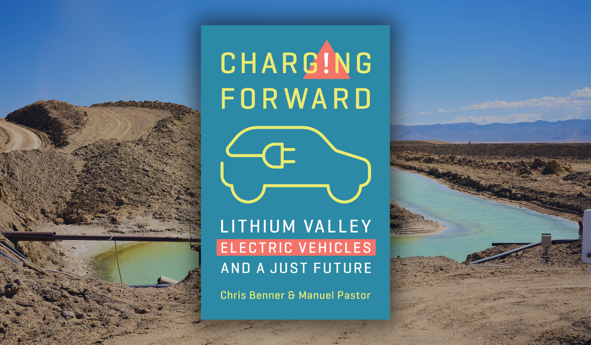
‘Charging Forward’: The Promise and Perils of Lithium Development in Imperial Valley
Bioneers | Published: March 10, 2025 Ecological DesignIndigeneityRestoring Ecosystems Article
California’s Salton Sea region is home to some of the worst environmental health conditions in the country. Recently, however, it has also become ground zero in the new “lithium gold rush”—the race to power the rapidly expanding electric vehicle and renewable energy storage market. The immense quantities of lithium lurking beneath the surface have led to predictions that the region could provide a third of global demand. But who will benefit from the development of this precious resource?
In this excerpt from “Charging Forward: Lithium Valley, Electric Vehicles, and a Just Future,” co-authors Chris Benner and Manuel Pastor examine the valley’s history, the economic and social structures behind its agricultural boom, and how they set the stage for today’s lithium development—raising critical questions about how the next boom will impact those who live and work in the valley.
Chris Benner is the director of the Institute for Social Transformation and the Everett Program for Technology and Social Change at UC Santa Cruz, where he is also the Dorothy E. Everett Chair in Global Information and Social Entrepreneurship, and a professor of environmental studies and sociology.

Manuel Pastor is the director of the Equity Research Institute (ERI) at the University of Southern California where he is also a Distinguished Professor of Sociology and American Studies and Ethnicity and the inaugural holder of the Turpanjian Chair in Civil Society and Social Change.
Copyright © 2024 by Chris Benner and Manuel Pastor. This excerpt originally appeared in “Charging Forward: Lithium Valley, Electric Vehicles, and a Just Future,” published by The New Press. Reprinted here with permission.
Full Steam Ahead
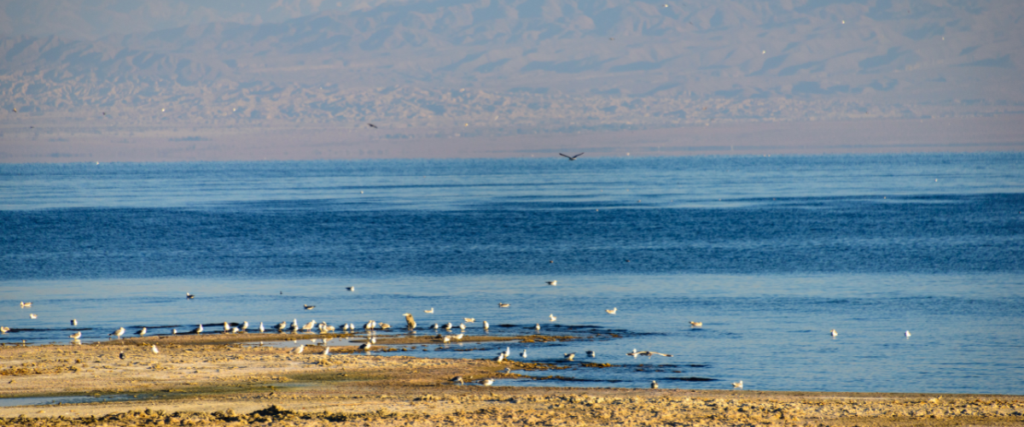
Stand at the shores of the Salton Sea, and you get both a hint of past glories and a foreboding sense of disrepair. The sea’s infamous North Shore Yacht Club was, at one time, reportedly the largest marina in the state of California. Once a vibrant locale for boating, skiing, and partying—where celebrities, including Frank Sinatra and the Beach Boys, came to play—it was shuttered in the 1980s.1 After decades of the site’s neglect, a walk from its parking lot to the shores reveals a lack of, say, yachts as well as most other human activity. In recent years, it has been remade into an infrequently visited museum and a somewhat more utilized community center, an incomplete resurrection that reminds the visitor just how much the fortunes of the sea, like the body of water itself, have sometimes risen and sometimes fallen (only to rise again?).
The ebbs and flows are no surprise: the Salton Sea has consistently been a place of both problems and promise. It came into being as an accident, to be sure—an overflowing canal that spilled into a usually empty desert sink and, despite desperate efforts to stanch the influx, soon filled it up to create California’s largest lake. But even this not-so-immaculate conception came about because of a buoyant optimism—and a dedicated booster mentality not so far from that of today’s lithium enthusiasm—that diverting water from its usual traditional route to the Gulf of Mexico would allow agricultural enterprise to flourish in the Imperial Valley. Flourish it did—and with agricultural output in Imperial County in the early twentieth century booming, white settlers gathered the spoils but not the crops, establishing a demand for Mexican labor and Mexican subjugation that would become baked into the economic and social structure.2
This mix of owners and workers, of happy, well-positioned winners and quiet (but sometimes not) disgruntled losers, set the terms for political conflicts that persist today. Mexican workers were initially welcomed as being more docile than earlier waves of Asian immigrants, but this fantasy of labor pacification was challenged by a 1928 strike by the Mexican Labor Union of Imperial Valley.3 These events reflected a highly racialized pattern of established interests seeking to dominate economic prospects but being occasionally met by fierce protest—and the current contention over what is to happen with the future of the Lithium Valley is, in some ways, but a continuation of that past and perhaps a final reckoning with the imbalance that was struck in an earlier era.
Equally emblematic (and problematic) of the region’s history was the early reliance on the view that nature was to be dominated and controlled, not respected and revived. If not for the water that irrigated the fields—steered away from its natural course and rerouted to soak a desert—the land would have had little value. Massive transformation of the physical environment, rather than adaptation to the world as it is, has been the norm in the Valley. So too has neglect: when the Salton Sea became a site for agricultural runoff and salinity rose, little was done to reverse the damage to human and animal health. As lithium takes center stage—with the technology of extraction still in the testing stage but excitement running hot enough to lead some leaders to discount community concerns—we are seeing echoes of what has gone before: the same hype, the same skewed complexion of who holds power, and the same desire to conquer nature in the name of progress.
As lithium takes center stage—with the technology of extraction still in the testing stage but excitement running hot enough to lead some leaders to discount community concerns—we are seeing echoes of what has gone before: the same hype, the same skewed complexion of who holds power, and the same desire to conquer nature in the name of progress.
Marx wrote, “Men make their own history, but they do not make it as they please; they do not make it under self-selected circumstances, but under circumstances existing already, given and transmitted from the past.”4 The history of the Imperial Valley is a tale of adventurers and investors seeking to create their own self-selected circumstances, but always tangling with a history and geography that exists and constrains. If the old begets (or at least structures) the new, understanding what has happened is critical—and that means exploring the continual efforts toward exploiting land and labor that have been hallmarks of the area. For if Lithium Valley is to be a fount of a more hopeful Green New Deal, we need to uncover and address the truly raw deal that corporate interests and elite local leaders have habitually handed to so many of its residents.
No Longer at Ease
The current interest in Imperial Valley is not about celebrating the agricultural past or re-creating the romanticism of the recreational boom days—it is about taking what lies below the desert and using it to launch a new sort of “white gold rush.” So how is it that the Salton Sea region came to be sitting on an abundance of geothermal energy and lithium?
The geologic depression where the dramas of extraction and exploitation have been and will be staged lies mostly below sea level—at its lowest point, about 280 feet below the sea.5 The result of mountain uplift and subsidence, the Salton Trough—the depression that is filled in part by the Salton Sea—is at the very southernmost extension of the San Andreas Fault, the boundary between the North American Plate and Pacific Plate, which slowly slide past each other at a rate of 0.8 to 1.4 inches a year.6 It also sits at the very north end of the East Pacific Rise, an underwater mountain range that extends through the Gulf of California and southward, off the coast of South America.
This interaction of plates and rise results in the stretching and thinning of the earth’s crust, narrowing the connections between subsurface molten rock and the surface. The complex network of faults and fractures that lie beneath the Salton Trough provides pathways for hot brine to reach nearer the surface, creating one of the largest geothermal resources in the world.7 And just as being at the crossroads of these tectonic plates helps explain the geothermal resources of the area, being at the crossroads of river and sea helps explain the presence of lithium.
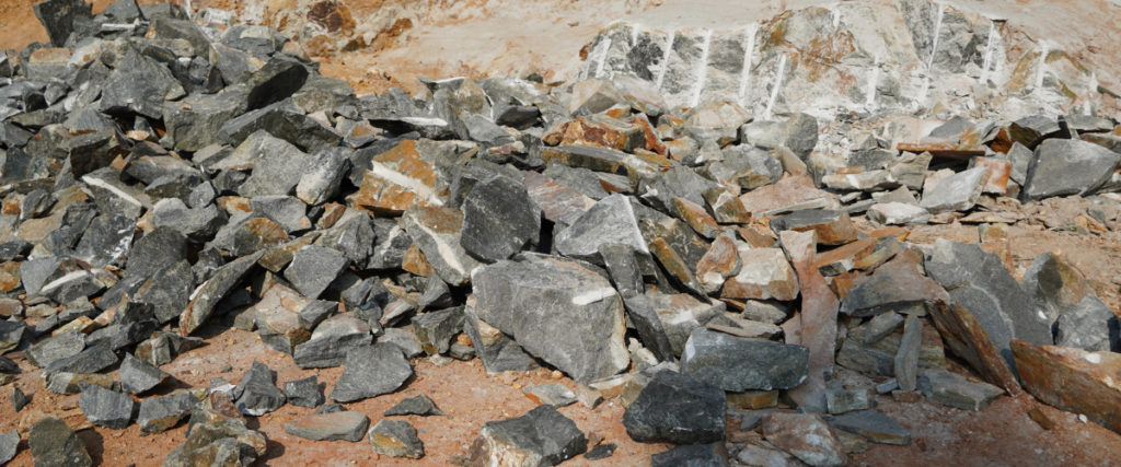
Once an underwater extension of the Gulf of California, the Salton Trough also lies near the delta of the Colorado River, whose outlet has meandered back and forth from the ocean to the Salton Trough with the shifting sands of time and the shifting sediments of the river delta. The region has received both ocean sediments and sediments from the Colorado River Basin for 5 million years or more, since roughly the time when the Colorado began to carve the Grand Canyon.8 The evaporating water helped concentrate lithium in the resulting layers of sedimentary rocks, which are now approximately 20,000 feet thick.9 The result: one of only a few places in the world where concentrations of lithium in geothermal brine is high enough to be economically viable with current (or at least, anticipated) technologies.10
This Land Is Our Land
Although lithium may wind up attracting new residents—just as irrigation in an earlier era led to a short-lived population boom—people have made their homes in this part of what is now known as Southern California for at least 12,000–14,000 years, and likely longer.11 In her masterful account of the evolution of the Salton Sea, Traci Brynne Voyles reminds us of what it was like when no one was trying to master the body of water or transform the surrounding land into a source of profit.12 Long before agribusiness, long before a lithium industry, long before a view that extraction was the ticket to prosperity, Native American tribes, the most prominent being a band of the Cahuilla nation, had found a way to live in harmony with the terrain.
Long before agribusiness, long before a lithium industry, long before a view that extraction was the ticket to prosperity, Native American tribes, the most prominent being a band of the Cahuilla nation, had found a way to live in harmony with the terrain.
As she notes, migration over long multigenerational cycles, in response to the changing terrain and the shifting waters, was the norm. Over the past two thousand years, the Salton Sink—the lowest part of the trough—has been filled six times due to flows from what would later be called the Colorado River. When that happened, local tribes retreated to higher ground; when the channel shifted back to what historically was the more normal exit into the Gulf of California and so the waters evaporated, the tribes returned to the receding shoreline.13 Modes of production and survival adjusted accordingly. In the years of flooding, people turned to eating fish and the birds that also came to eat the new bounty. In the years of a dry Salton Sink, beans harvested from mesquite trees were key to nutrition.14
The arrival of Spanish settlers to California, first in the 1600s in present-day Baja and later expanding north, could have disrupted this rhythm extensively, but the Cahuilla were partially spared as the Spanish were more interested in establishing a mission system closer to the coast. Both California and what would later be called the Imperial Valley passed to Mexico when that country-to-be’s war of independence severed the colonial ties to Spain in the early nineteenth century; this interregnum lasted around twenty-five years until the United States wrestled away California (and much of the rest of the Southwest), just in time for the territory’s midcentury Gold Rush and its quick declaration as a state of the Union.
The desert lands of the Cahuilla were initially thought to be just that—desert—and that may be one reason why the tribe was initially less subject to the diseases and overwork wrought by colonialism and neocolonialism, factors that created a flood of risk and oppression that helped reduce California’s overall Indian population from about 150,000 people in 1846 to about 30,000 in 1870.15 Gold was discovered near Twentynine Palms in 1874, and while it never produced a big haul, it is ironic that reservations for the Cahuilla people were created by executive order just two years later, successfully corralling the local population away from minerals and into controllable borders.16 Appropriately enough, the official land of one of the bands of Cahuilla, the Torres Martinez Desert Cahuilla Indians, included a large part of the Salton Sink, something that was consistent with historic cultural patterns but would be problematic when the Sink became the Sea.
Gold might not have been in abundance in this more desolate part of Southern California, but that did not stop the land fever that occupied so much of the Golden State at the time. Of course, to make the land valuable required water, something in short supply in a desert. While there were a few early efforts to bring water from the Colorado River, it was not until the 1890s that the strategy became more refined. Interestingly, the undertaking was private: speculators were betting that they could divert water without government help and thus capitalize on all the benefits.
Bait and Switch
The firm seeking to exploit the area, the California Development Company (CDC), figured out an innovative if legally questionable scheme. It developed a combination human-built and natural canal system that, starting in 1901, took water from the Colorado River a few miles north of Mexico and steered it west and south across the border to connect to the dry riverbed of the Alamo River, which then flowed eventually back north across the border to the Salton Sink. In the process, the water, which could not be privately owned under U.S. law, became the property of the CDC’s Mexican subsidiary and reentered the United States as private property not subject to U.S. regulations—quite a system for, as Voyles puts it, “laundering water the way mobsters laundered money.”17
Private capital also decided to rechristen the location, much as is happening in the current era of lithium. During this time, the CDC recruited the Canadian-born George Chaffey to help develop the irrigation scheme, an engineer who had become at least as well known for his marketing skills as the engineering skills he demonstrated in bringing irrigation and land development to other dry areas in Southern California and Australia.18 While he was certainly helpful with both system design and water laundering, among his other most important contributions was that he “changed the name of the region from the Colorado Desert to the Imperial Valley in order to attract settlers.”19 “Valley” certainly sounded more welcoming than “Desert,” and the first part of the moniker, derived from a separately formed Imperial Land Company that sought to colonize the area, stuck. It was eventually adopted as the official namesake for Imperial County, the last county to be incorporated into California in 1907.
In short, just as Lithium Valley today derives its new name from a get-rich scheme—albeit one with a nod toward environmental sustainability—its old name was also a marketing gimmick, but one without much in the way of redeeming environmental value.
In short, just as Lithium Valley today derives its new name from a get-rich scheme—albeit one with a nod toward environmental sustainability—its old name was also a marketing gimmick, but one without much in the way of redeeming environmental value. While private capital led the initial development efforts, federal authorities also wanted in. Sensing that the government might actually be able to provide cheaper water than profit-hungry speculators, local users supported this plan. The problem was that to assert federal control over the water being diverted, the portion of the Colorado River below Yuma, Arizona, needed to be declared a navigable waterway (in which case, private extraction of water was a crime and the feds had every right to push private investors aside). Various studies and expeditions could not successfully establish that finding, but the pressure of local users and financial stress led the CDC to sell irrigation developments to the federal government in an agreement that was inked in 1904.
Turns out that the deal was a bit of bait and switch: even as they were talking with the U.S. government, the owners of the CDC quietly negotiated an alternative deal with Mexico’s then-dictator Porfirio Díaz to replace the contemporary canal they’d built, which started in the United States before looping into the territory of our southern neighbor, with a cutoff that would actually start on the Mexican side. The advantage of the Mexican cutoff was that it would avoid the drama with the federal government altogether—that is, there would be no tapping into a potentially navigable river on American soil, and any claims the U.S. government might subsequently make about water coming back in from Mexico would get entangled in international treaties. It seemed like an elegant (albeit sneaky) solution, and Mexico was promised half of the flow as payment for its troubles.20 Troubles soon followed: summer floods in 1905 broke through the cutoff and, by that December, the entire contents of the Colorado River were flowing into the Salton Sink.21
The area’s Indigenous population had learned to live with floods from long water cycles, but this time no one, including the local Torres Martinez Desert Cahuilla Indians now constrained on their reservation, was prepared for such a sudden deluge.22 Overwhelmed by the disaster and their own failure to build a lasting fix, the canal builders turned for assistance to Southern Pacific, a railroad company eager to protect its transcontinental tracks from washing away. Nearly two years of failed attempts at redirecting the new tide ensued until early 1907, when a complicated system of levees finally did the job.23 The Sink was now a Sea, and in 1911, the legal troubles of the California Development Company—under pressure because of its role in the breach—led to the creation of the Imperial Irrigation District (IID), an agency that remains one of the region’s most powerful players to this day.24
A Boom for Who?
With IID securing water rights to the Colorado River, agricultural development began in earnest. In 1910, 176,000 acres of the Valley were under cultivation; in 1920, that figure was 311,000, a pace of growth that made it one of the most rapidly expanding counties in the state in terms of cultivated acreage.25 Population growth was similarly rapid: the resident count grew from around 13,600 inhabitants in 1910 to 43,500 in 1920.26 Large agribusiness received a further boost by the 1913 Alien Land Law, later significantly strengthened by the 1920 Alien Land Law—efforts which were aimed at sharply curtailing ownership opportunities for Japanese immigrants and thereby provided an opening for bigger firms to monopolize land.27
The boom in crops required labor, and Mexican workers filled the demand. Since landowners had every intention of generating wealth but no intention of sharing it, the growing number of frustrated Mexican workers responded with a strike in 1922. Militant in its tone but less effective in its implementation, the strike was easily derailed by a combination of modest wage hikes and the use of non-Mexican workers, including Japanese laborers who were facing limited options given the restrictions on buying or leasing land that were then biting as a result of California’s xenophobic Alien Land Laws.28 A subsequent labor conflict in 1928 was also Mexican-initiated; by this time, Mexico-origin workers made up 90 percent of those laboring in the fields. Labor action was encouraged by the Mexican consul, and reflected the discontent of not just migrant but U.S.-resident workers.29
Growers and local authorities teamed up to stop this new work stoppage, with the local sheriff expanding his troops by temporarily hiring field bosses to better follow the admonition of the board of supervisors to “arrest agitators.”30 Union leaders backed off from explicit calls to abandon the fields in order to avoid entanglements with the law, but workers did not get that message and stayed away for a few days. The lack of leadership and the active repression by authorities, however, led to disarray; the fields were soon back in action (and worker wage demands were quietly addressed, although other aspects of their nascent demands were not).
The importance of the strike was that it set the template for racialized and corporate domination in Imperial County.
The importance of the strike was that it set the template for racialized and corporate domination in Imperial County. By 1930, the first and only year that the Census enumerated Mexicans (that remained the case until 1980, when “Hispanic” became a new official category and “Mexicans” a subcategory), 21,618 Mexicans made up Imperial County’s total population of 60,903; another 3,214 residents were Indian, Chinese, or Japanese. Mexicans accounted for 6.5 percent of the state of California’s population but over a third of Imperial County, making this demographically the most Mexican of any county in California by far.31 This was very likely an undercount of the Mexican presence since the census enumeration was of residents and did not include the migrant workers who would swoop in during harvest; still, it helps to explain how the local powers’ suppression of the voice of Latinos and labor became woven into the region’s political DNA.
Left Behind in the Golden State
The structural template for the Valley was set in other ways as well. A more stable source of water—not subject to canal breaks and not wandering its way up from Mexico—was put in place during the 1930s as construction began on the All-American Canal, so named because it avoided any detours into Mexico even as it powered an agricultural economy that had many Mexicans detouring their own way to the
Imperial Valley. The first water was delivered from the canal in 1940, just in time for a boom in agricultural production that would be triggered by wartime demands. Between 1940 and 1950, the value of agricultural production in Imperial County more than doubled in real inflation-adjusted dollars even though the population level barely budged, suggesting both a welcome increase in productivity and the presence of nonresident workers.32
This lack of population growth made the Imperial Valley an outlier. California’s population increased by 22 percent in the 1930s—leaning against the Great Depression winds by attracting Dust Bowl refugees and others from different states—then exploded another 53 percent in the boom years of World War II as wartime employment surged, and then another 48 percent in the 1950s as suburban development beckoned domestic migrants from across the United States. Imperial County, by contrast, saw its population fall by 2 percent in the 1930s, tick up by 5 percent in the 1940s, and then increase at a relatively languid 14 percent in the 1950s. If we look at the whole period from 1930 to 1960, Imperial County ranked 52nd of California’s 58 counties in terms of population expansion; nearly all the counties with even slower growth were located in lightly populated areas in the Sierra Nevada.33

The lagging nature of the county persisted even as the Golden State became, well, more Golden. The 1960s were a period of bounty for California—the population continued to rise, the state made a commitment to a master plan for higher education, and the fundamentals were put in place for a technology boom that would eventually launch Silicon Valley into global awareness.34 Little of that seemed to spill over to Imperial County: it saw tepid population growth of 3 percent and agriculture remained key to its economy, with an estimated quarter of the male labor force involved in agricultural production in 1970. Of note, that amounted to about four thousand total resident agricultural workers, but there were another estimated six thousand to twelve thousand workers regularly crossing the border to work in the fields.35
In short, the region was better lubricated by water from the Colorado River, better fueled by agricultural demand, and better staffed by a growing share of disempowered Latino and immigrant workers. This may have brought fortunes to some but it was hardly the basis for widespread prosperity: a system that relied on exploiting labor and extracting water was not a recipe for creating the middle-class lifestyle that beckoned so many to California.36 All this was reinforced by a political constellation that gave agribusiness more or less free rein, offered local communities minimal voice, and provided scant attention to public investment needs. With the world swirling and the future beckoning, Imperial County found itself stuck in place and, given its racialized labor system, stuck in time.
The Shores of Change
Another thing stuck in place was the Salton Sea itself. The flooding of 1905–7 had created a new lake—which in the era of the Cahuilla would have evaporated over time and which, according to contemporary predictions, was supposed to recede to nothing by the 1920s.37 But even though the growth of agriculture absorbed some of the new water flowing from the Colorado, the sea found its level propped up by runoff from the growing agricultural sector. The sea was here to stay but not necessarily to thrive, particularly as the water flowing into the landlocked body of water was managing to pick up pesticides and other contaminants on its way.
It was a disaster in the making—but capitalism, as can be seen in the drilling-happy and climate-ignoring strategies of fossil fuel companies that continue to this day, can often find a way to make money even as environmental collapse lurks in the background.38 Seeing the buoyancy of an increasingly saline sea—and thinking just enough ahead to make profits but not far enough ahead to save the planet—investors poured in to convert the not-yet-toxic sea into a recreational playground that would attract visitors for boating, waterskiing, and fishing.
NOTES
- “Not Quite Such a Shore Thing,” Never Quite Lost (blog), August 26, 2017,
https://neverquitelost.com/2017/08/26/not-quite-such-a-shore-thing/. - It was reported that in 1920, half of the state’s agricultural labor force was Mexi-
can, and the share likely ticked up as the subsequent decade brought significant labor migration. Surely, the presence was even higher in the border-proximate fields of the Imperial Valley; see Carey McWilliams, Factories in the Field: The Story of Migratory Farm Labor in California (Berkeley: University of California Press, 2000), 124–26.. - Ibid., 129–30.
- This is the most popular representation of the quote from Marx’s monograph,
“The Eighteenth Brumaire of Louis Bonaparte”; see https://www.marxists.org/archive/marx/works/1852/18th-brumaire/ch01.htm. Wordings of the quote differ depending on the translation. - The surface of the Salton Sea itself is about 230 feet, so this refers to the deepest part of the sea and the Salton Sink that it filled.
- Pacific Coastal and Marine Science Center, “Assembling a Seismic History of the Southern San Andreas Fault Zone Beneath Salton Sea,” U.S. Geological Survey, August 29, 2022, https://www.usgs.gov/centers/pcmsc/news/assembling-seismic-history-southern-san-andreas-fault-zone-beneath-salton-sea.
- Kaspereit et al., “Updated Conceptual Model and Reserve Estimate for the
Salton Sea Geothermal Field, Imperial Valley, California.” - David Alles, “Geology of the Salton Trough” (Bellingham: Western Washington
University, October 28, 2011), https://citeseerx.ist.psu.edu/document?repid=rep1&ty
pe=pdf&doi=564f85471b8bdc52105c05d8fb31cdf338609bb2. - Leland W. Younker, Paul W. Kasameyer, and John D. Tewhey, “Geological, Geophysical, and Thermal Characteristics of the Salton Sea Geothermal Field, California,” Journal of Volcanology and Geothermal Research 12 (1982): 221–58.
- Sanjuan et al., “Lithium-Rich Geothermal Brines in Europe.”
- Damon B. Akins and William J. Brauer Jr., We Are the Land: A History of Native
California (Berkeley: University of California Press, 2021). - Traci Brynne Voyles, The Settler Sea: California’s Salton Sea and the Consequences of Colonialism (Lincoln: University of Nebraska Press, 2022).
- Thomas K. Rockwell et al., “The Late Holocene History of Lake Cahuilla: Two
Thousand Years of Repeated Fillings Within the Salton Trough, Imperial Valley,
California,” Quaternary Science Reviews 282 (April 2022): 107456. - Voyles, The Settler Sea, 23–33.
- Brendan C. Lindsay, Murder State: California’s Native American Genocide,
1846–1873 (Lincoln: University of Nebraska Press, 2012); Voyles, The Settler Sea, 48. - The executive order of May 15, 1876, signed by President Ulysses S. Grant,
established eight small reservations for different bands of Cahuilla Indians. The Torres and Martinez reservations were combined in 1891. See Valerie Sherer Mathes and Phil Brigandi, Reservations, Removal, and Reform: The Mission Indian Agents of Southern California, 1878–1903, 1st ed. (Norman: University of Oklahoma Press, 2018), loc. See also “Torres Martinez Desert Cahuilla Indians,” Southern California Tribal Chairmen’s Association, https://sctca.net/torres-martinez-desert-cahuilla-indians/. - Voyles, The Settler Sea, 68.
- Chaffey gained success in bringing irrigation and land development to Etiwanda
and Ontario in the Inland Empire in the early 1880s, where he earned a reputation as a fierce if not entirely ethical marketer. He then moved to Australia, which he saw as having similar opportunities in dry land development as California, and where he is credited with creating the first large-scale irrigation townships in the country, in the dry northern plains of Victoria. The development of what became the town of Mildura included questionable business practices that resulted in an official Royal Commission inquiry and eventual insolvency, followed by his return to California in the 1890s. The scent of scandal is, it seems, a consistent feature for many players in the historic and contemporary development of Imperial Valley. See Jennifer Hamilton-Mckenzie “Utopos? A Consideration of the Life of Irrigationist, George Chaffey”, Australasian Journal of American Studies 32, No. 2 (2013): 63-80. The continuing connections between Australia and California are reflected not only in the fact that Australia is the largest global source of lithium, but also in the company now pioneering direct lithium extraction, Controlled Thermal Resources, which is Australian in origin and now redomiciled in the United States. Its CEO, Rod Colwell, was a property developer in Brisbane, Australia, and has also made the move. See John McCarthy, “Colwell’s $1 Billion ‘Green’ Lithium Plan Starts Coming Together,” InQueensland, October 11, 2022, https://inqld.com.au/business/2022/10/12/colwells-1-billion-green-lithium
-plan-starts-coming-together/. - Robert G. Schonfeld, “The Early Development of California’s Imperial Valley:
Part I,” Southern California Quarterly 50, no. 3 (September 1968): 289. - Ibid., 301.
- Voyles, The Settler Sea, 73. At one point, the new Salton Sea was rising seven
inches a day; see Kelley, Where Water Is King, 66. - It was the Native American population, however, that comprised “most of the
labor force that was recruited to serve as the frontline in the (eventual) flood-abatement offensive”; see Kelley, Where Water Is King, 69. - The flooding headed to the sink along the Alamo and what would become the
New River channel. The New River subsequently became known as a notorious source of noxious pollution as it became a channel for sewage, toxics, and other contaminants, much of which was contributed as the river makes its way north from Mexico through busy Mexicali, marking yet another environmental disaster affecting the people of Imperial County. See Ian James and Zoe Meyers, “This River Is Too Toxic to Touch, and People Live Right Next to It,” Desert Sun, December 5, 2018, https://www.desertsun.com/in-depth/news/environment/border-pollution/poisoned-cities/2018/12/05/toxic-new-river-long-neglect-mexico-border-calexico-mexicali/1381599002/. - This was not the first time that water had suddenly appeared: in 1891, there was a flood that caused a new lake to appear, but this was part of the more regular historical cycle. See Voyles, The Settler Sea, 60.
- Benny J. Andrés, Power and Control in the Imperial Valley: Nature, Agribusi-
ness, and Workers on the California Borderland, 1900–1940, 1st ed. (College Station: Texas A&M University Press, 2015), 70; U.S. Census Bureau, “Fourteenth Census of the United States: State Compendium, California” (Washington, DC: U.S. Census Bureau, 1924), 75, https://www.census.gov/library/publications/1924/dec/state-compendium.html. - U.S. Census Bureau, “Fourteenth Census of the United States: State Compen-
dium, California,” 11. - There is some debate about how effective the laws were, particularly given the
strategies of immigrant owners to evade the restrictions. There was, however, a sharp drop in Japanese-owned agricultural landholdings in California between 1920 and 1925, although this was partly (but not wholly) driven by a larger slump in agriculture in that period. See Yuji Ichioka, “Japanese Immigrant Response to the 1920 California Alien Land Law,” Agricultural History 58, no. 2 (1984): 170; Masao Suzuki, “Important or Impotent? Taking Another Look at the 1920 California Alien Land Law,” The Journal of Economic History 64, no. 1 (2004): 125–43; and Leah Fernandez, “Breaking Ground: Imperial Valley’s Japanese and Punjabi Farmers, 1900–1933.” Hindsight Graduate History Journal 5 (2011). On the dynamics that led to this anti-Asian legislation, see Brian J. Gaines and Wendy K. Tam Cho, “On California’s 1920 Alien Land Law: The Psychology and Economics of Racial Discrimination,” State Politics & Policy Quarterly 4, no. 3 (2004): 271–93. - Andrés, Power and Control in the Imperial Valley: Nature, Agribusiness, and
Workers on the California Borderland, 1900–1940, p. 132. - Charles Wollenberg, “Huelga, 1928 Style: The Imperial Valley Cantaloupe
Workers’ Strike,” Pacific Historical Review 38, no. 1 (February 1969): 47. - Ibid., 54.
- The runner-up, at a quarter of the population, was Ventura County, an agricul-
tural area in the Central Coast region. Data is from the 1930 U.S. Census, utilizing state tables available at “1930 Census: Volume 3. Population, Reports by States,” https://www.census.gov/library/publications/1932/dec/1930a-vol-03-population.html. - This is calculated by taking the total agricultural value for Imperial County reported in the Imperial County Farm Bureau Crop reports for 1940 and 1950, and deflating by the U.S. Consumer Price Index for those years. The second of these crop reports includes soil improvements in the value total, so the two series are not exactly identical; that margin, however, is a negligible 0.2 percent of the total in 1950. See “Imperial County: Crop Reports & Crop Report Plus,” Imperial County Farm Bureau, https://www.icfb.net/crop-reports.
- Another slow grower was land-constrained San Francisco. Population growth
calculated from data available from the Historical Census Populations of California, Counties, and Incorporated Cities, 1850–2010, prepared by the California State Data Center, and obtained at http://www.bayareacensus.ca.gov/historical/historical.htm. - Pastor, State of Resistance.
- The raw numbers on resident agricultural workers are taken from an IPUMS
National Historical Geographic Information System (NHGIS) extract from the 1970 Census; see Ruggles et al., “IPUMS USA.” For the estimates of migrant workers, see Martin J. Pasqualetti, James B. Pick, and Edgar W. Butler, “Geothermal Energy in Imperial County, California: Environmental, Socio-economic, Demographic, and Public Opinion Research Conclusions and Policy Recommendations,” Energy 4, no. 1 (February 1979): 72. - In 1970, of the 58 counties in the state of California, Imperial ranked 45 in
terms of homeownership. Most of the counties toward the bottom of that list were located in the higher-cost coastal urban areas, including Los Angeles, San Diego, San Francisco, Alameda, Santa Barbara, and Monterey, though there were other poor rural areas like Imperial in the last-runner mix as well. Data from the 1970 Census, as taken from Steven Manson, Jonathan Schroeder, David Van Riper, Tracy Kugler, and Steven Ruggles. IPUMS National Historical Geographic Information System: Version 17.0 Minneapolis, MN: IPUMS. 2022. - William DeBuys and Joan Myers, Salt Dreams: Land & Water in Low-Down
California (Cork, Ireland: BookBaby, 2001), loc. 2563.
This excerpt has been reprinted with permission from “Charging Forward: Lithium Valley, Electric Vehicles, and a Just Future” by Chris Benner and Manuel Pastor, published by New Press, 2024.